|
|
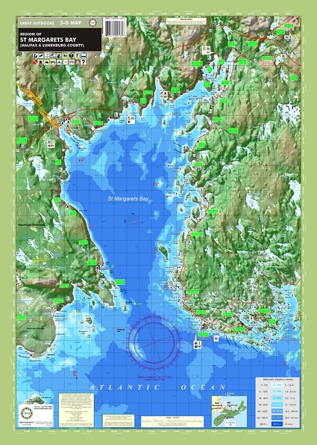
St. Margaret's Bay and Region #184ISBN: 9782895891888Author: Trak Maps Waterproof map from TrakMaps.Colour fishing map showing lake depths and surrounding topography. 20" x 28". Chart of Margaret's Bay including locations of buoys, hazards, roads, camping and picnic sites and outdoor recreational activities.Scale 1:50000 |
World Of Maps.com
Established 1994 - "For the Love of Travel and Maps." - Ottawa, Ontario
Call Customer Service toll free: 1-800-214-8524