|
|
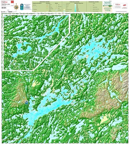
Manitou Lake #514 (Northwest Ontario)ISBN: TRAK514Author: Trak Maps Waterproof map from TrakMaps.Colour fishing map showing lake depths and surrounding topography. 36" x 38". Chart of Upper and Lower Manitou Lake with surrounding topography in 3D. Includes locations of hazards, fishing spots, area lakes and lodging. Scale: 1 : 40 000. |
World Of Maps.com
Established 1994 - "For the Love of Travel and Maps." - Ottawa, Ontario
Call Customer Service toll free: 1-800-214-8524