|
|
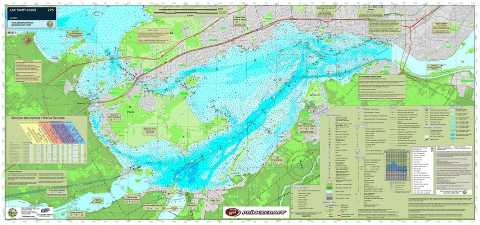
Lac Saint-Louis #275ISBN: 9782895892793Author: Trak Maps Waterproof map from TrakMaps.Colour fishing map showing lake depths and surrounding topography. Depth (bathymetry). Navigation aids (Buoys, lights, beacons). Hazards (rocks, shoals, post). Nature of the seabed. Docksides and ramps. Marinas services. Fishing from the shore line. Fishing spots. Wildlife and Botanical sites. 22" x 47" Scale: 1:35,000 |
World Of Maps.com
Established 1994 - "For the Love of Travel and Maps." - Ottawa, Ontario
Call Customer Service toll free: 1-800-214-8524