|
|
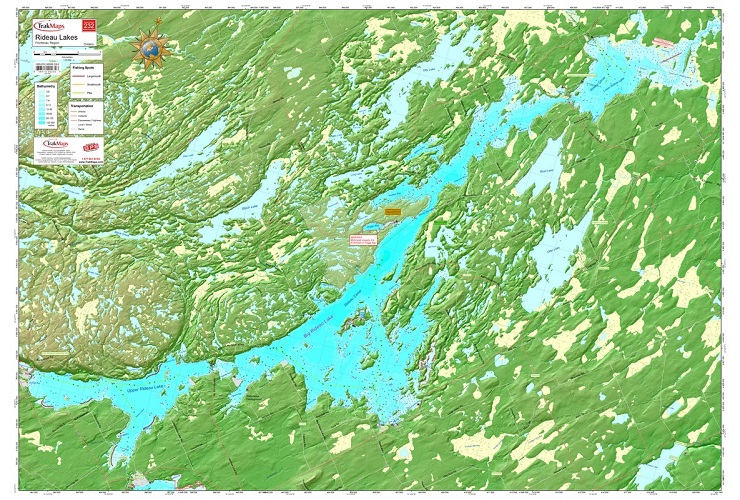
Rideau Lakes Wallmap #232 (Frontenac)ISBN: 9782895892366Author: Trak Maps Waterproof map from TrakMaps.Colour fishing map showing lake depths and surrounding topography. 28" x 40". Chart of Rideau Lakes with its numerous bays and islands, locations of hazards, buoys, fishing spots, marinas, boat launches as well as surrounding lakes, roads, trails, camping and picnic sites and look-out points. Scale: 1:33000 |
World Of Maps.com
Established 1994 - "For the Love of Travel and Maps." - Ottawa, Ontario
Call Customer Service toll free: 1-800-214-8524